


VERNON 289 Voting District, Lake County, Illinois
About
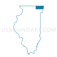
Outline

Summary
| Unique Area Identifier | 572034 |
| Name | VERNON 289 Voting District |
| County | Lake County |
| State | Illinois |
| Area (square miles) | 0.16 |
| Land Area (square miles) | 0.16 |
| Water Area (square miles) | 0.00 |
| % of Land Area | 100.00 |
| % of Water Area | 0.00 |
| Latitude of the Internal Point | 42.16283600 |
| Longtitude of the Internal Point | -87.97984920 |
Maps


Graphs
Select a template below for downloading or customizing gragh for VERNON 289 Voting District, Lake County, Illinois


Neighbors
Neighoring Voting District (by Name) Neighboring Voting District on the Map
- VERNON 277 Voting District, Lake County, IL
- VERNON 288 Voting District, Lake County, IL
- VERNON 290 Voting District, Lake County, IL
- VERNON 292 Voting District, Lake County, IL
Top 10 Neighboring County Subdivision (by Population) Neighboring County Subdivision on the Map
Top 10 Neighboring Place (by Population) Neighboring Place on the Map
Top 10 Neighboring Elementary School District (by Population) Neighboring Elementary School District on the Map
Top 10 Neighboring Secondary School District (by Population) Neighboring Secondary School District on the Map
Top 10 Neighboring State Legislative District Lower Chamber (by Population) Neighboring State Legislative District Lower Chamber on the Map
- State House District 51, IL (117,696)
- State House District 59, IL (112,327)
- State House District 53, IL (101,209)
Top 10 Neighboring State Legislative District Upper Chamber (by Population) Neighboring State Legislative District Upper Chamber on the Map
- State Senate District 26, IL (248,598)
- State Senate District 30, IL (213,957)
- State Senate District 27, IL (207,953)